
2026 Study Architecture Student Showcase - Part I
Welcome to the 2026 Study Architecture Student Showcase!
Each year, Study Architecture and ACSA invite architecture faculty worldwide to celebrate graduating students whose work embodies excellence in architectural education. The submitted theses, projects, and capstones reflect the high-level skills and concepts taught in architecture schools. With the fall semester in full swing, we are excited to share these outstanding projects with you over the next few weeks.
With topics ranging from Infrastructure and Equity to Sustainability and Housing, each project has the power to inspire current and future architecture students. Tune in every Tuesday and Thursday for a new installment.
Today’s edition of the showcase features projects that highlight innovative designs in urbanism: the study of how people live and interact within the built environment. From modeling city growth using planning tools and climate-conscious urban developments to urban civic spaces and adaptive typology, each project uses innovative designs to highlight the intersection of architecture and urban design.
Scroll down to explore these awesome projects!
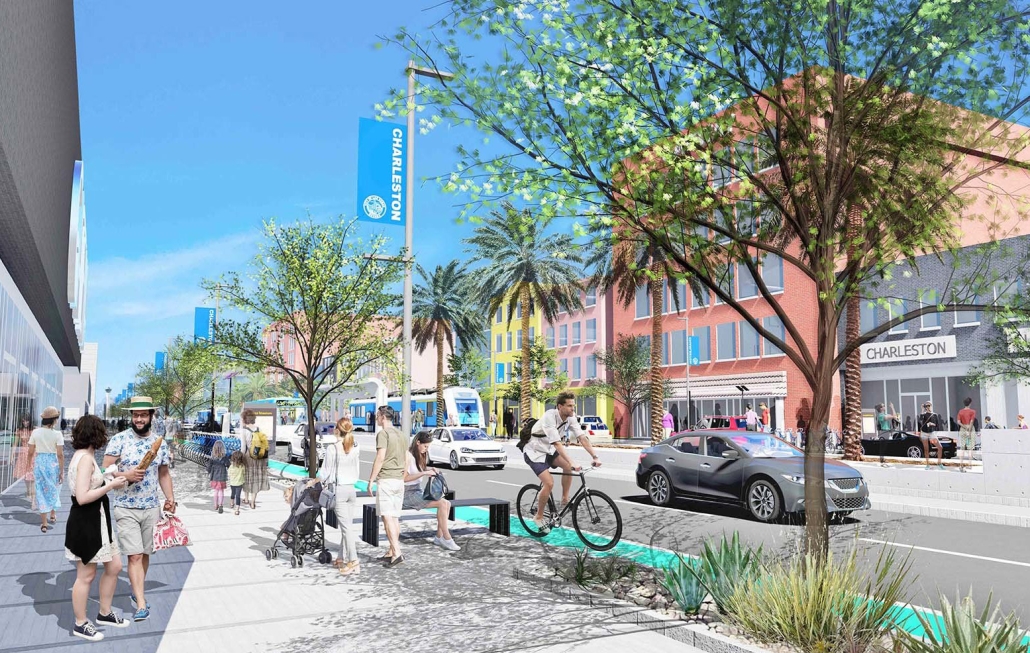
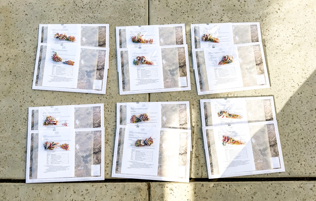
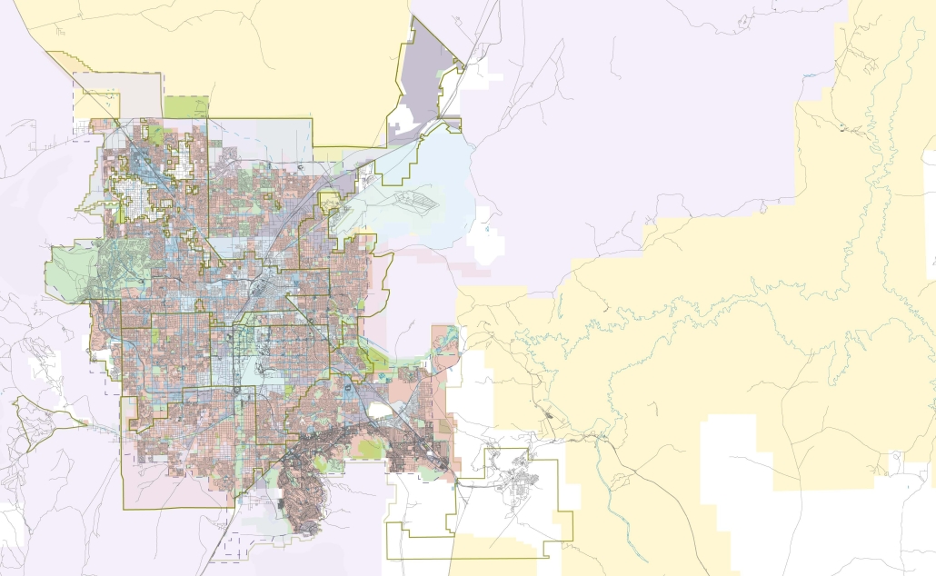
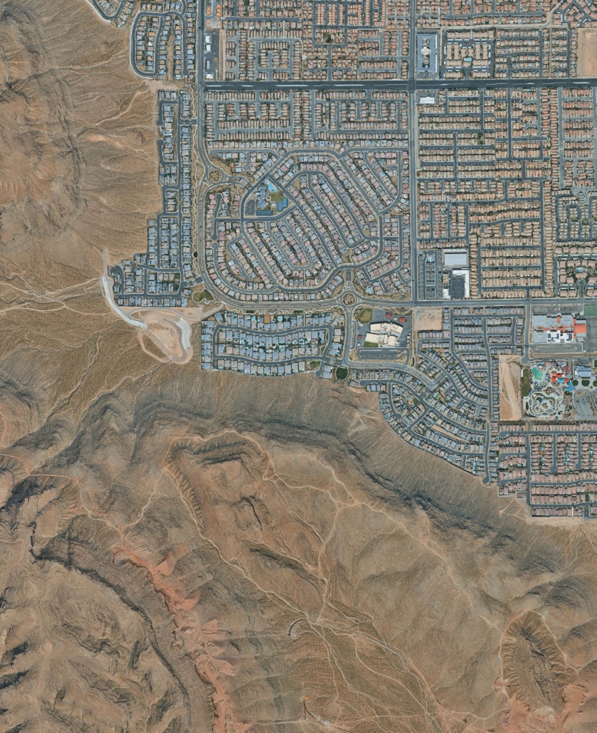
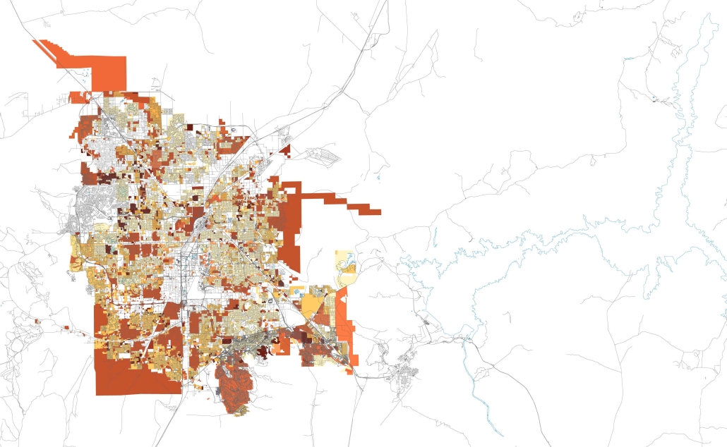
Living Within Limits: Urban Growth Boundary in the Las Vegas Valley by Kayla Larose, M. Arch. ‘26
University of Nevada, Las Vegas | Advisor: Jeff Roberts
Current planning tools like urban growth boundaries (UGBs) are often framed primarily as restrictive regulatory mechanisms, lines on a map meant to curb sprawl, rather than as generative opportunities for architectural and urban innovation. This limited interpretation overlooks the transformative potential of UGBs to serve as catalysts for reimagining how cities can and should grow, adapt, and thrive within ecological limits.
For cities like Las Vegas, the establishment of a UGB could be reframed not as a constraint, but as a design challenge that encourages density, efficiency, and creativity within a finite footprint. Instead of replicating low-density sprawl, the city could embrace an arcology-inspired model of urbanism: compact, self-sustaining, resource-conscious, and deeply integrated with the desert environment. Within this boundary, the pressure to innovate could encourage mixed-use, walkable neighborhoods, resilient infrastructure, and climatic architectural strategies that harmonize with the harsh yet delicate desert ecology.
The intersection of architecture and urban design is at the center of this exploration. By viewing growth boundaries as a design framework rather than a limitation, architects, planners, and policymakers can collaboratively transform the UGB into a platform for pioneering forms of desert urbanism. In doing so, Las Vegas has the potential not only to contain growth but to redefine it while transforming necessity into a model of visionary, resilient development that demonstrates how finite resources can foster rather than hinder urban possibility.
Click here to take a closer look at the project.
Larose was accepted into the 2026 Venice Studio (read more).
Instagram: @thistleamongroses, @jdroberts24
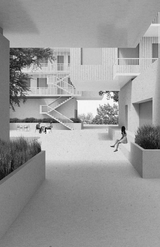
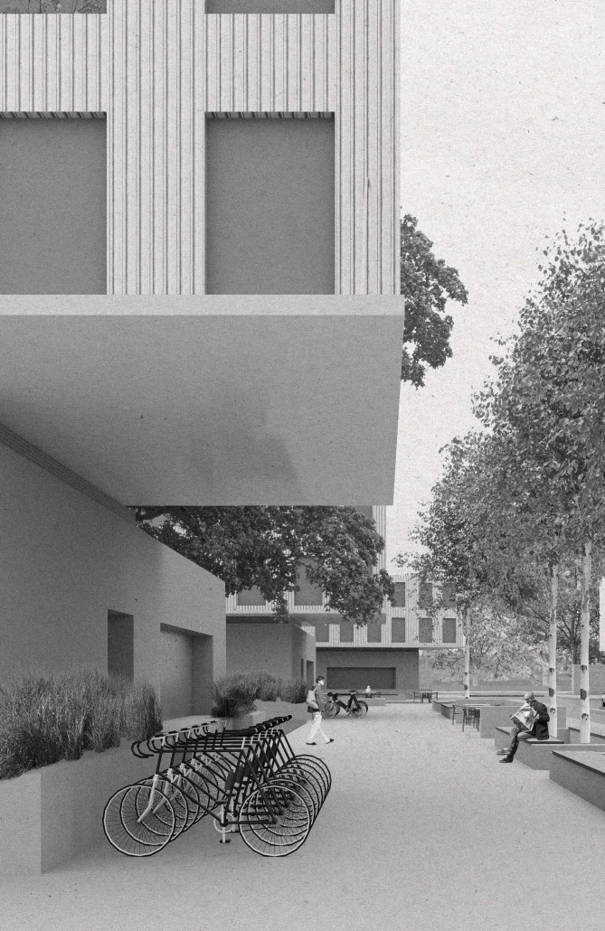
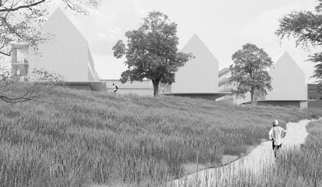
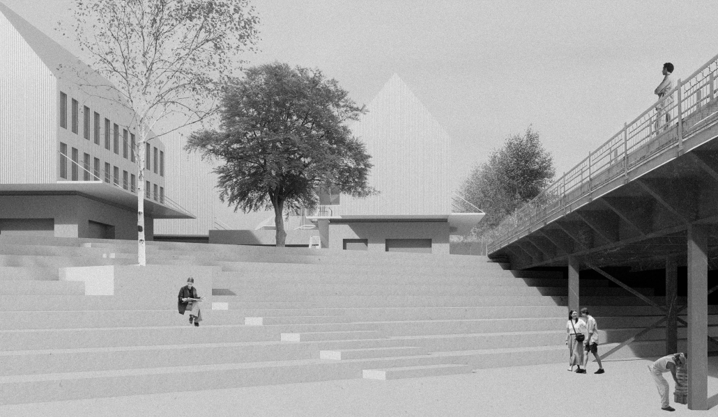
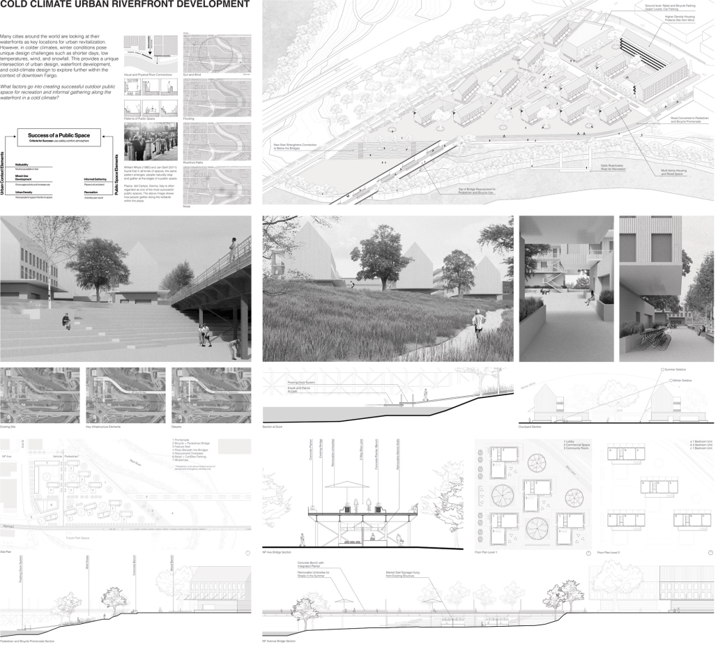
Cold Climate Riverfront Development: Using People-First Design To Connect Fargo’s Downtown to the River by Jade Biewer, M.Arch. ’26
North Dakota State University | Advisor: Charlott Greub
This thesis examines the intersection of urban design, riverfront development, and cold-climate design to establish a framework for a mixed-use riverfront project in Fargo’s Downtown. By synthesizing theories on public space revitalization, key considerations in waterfront development and research on climatic responses for cold-weather cities, this research identifies key principles to support year-round urban life along the riverfront.
By using downtown Fargo and the Red River as a reference, this research synthesizes knowledge on these subjects in order to work towards creating a design proposal for an urban riverfront development prioritizing outdoor space, year-round use, resiliency, and a strong reconnection to the urban fabric of downtown.
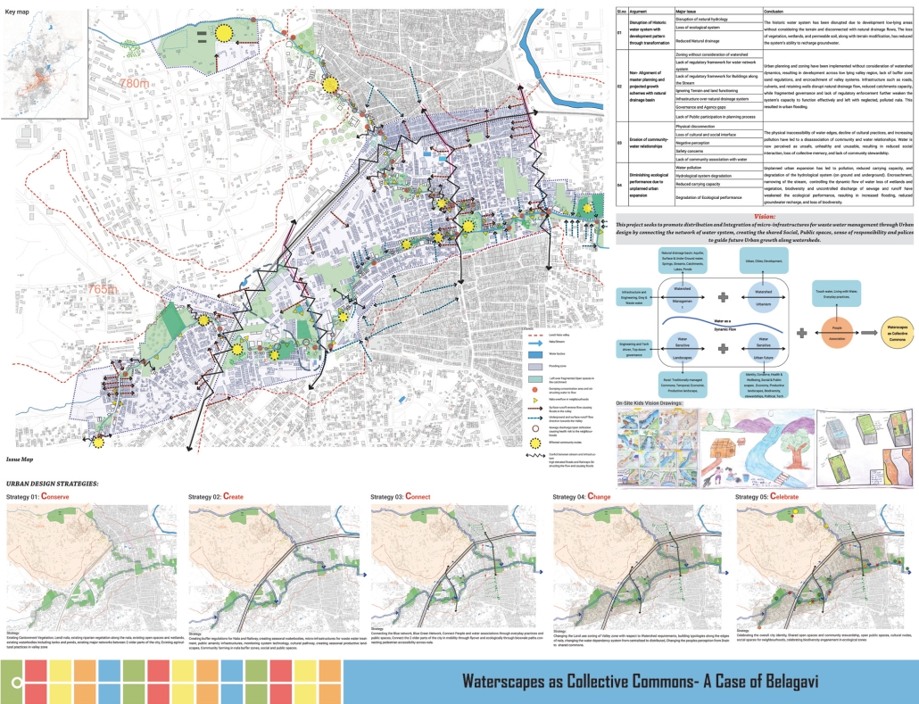
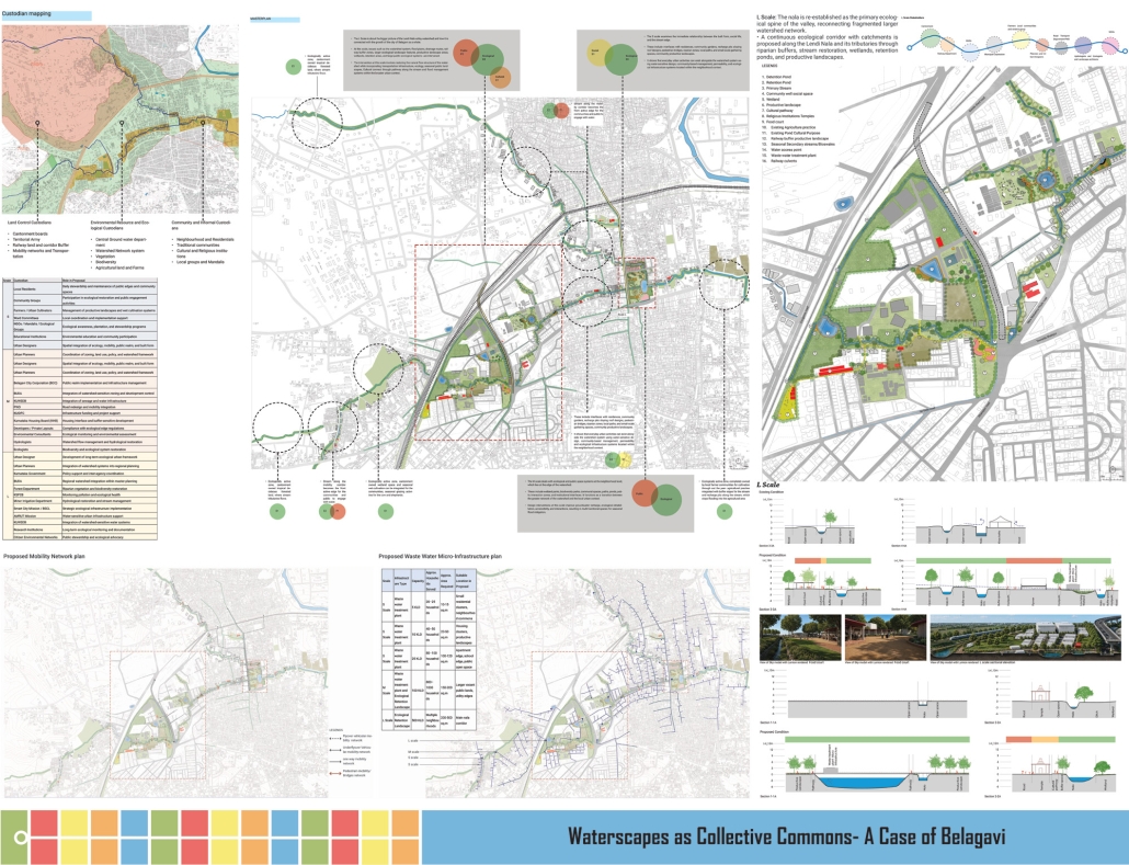
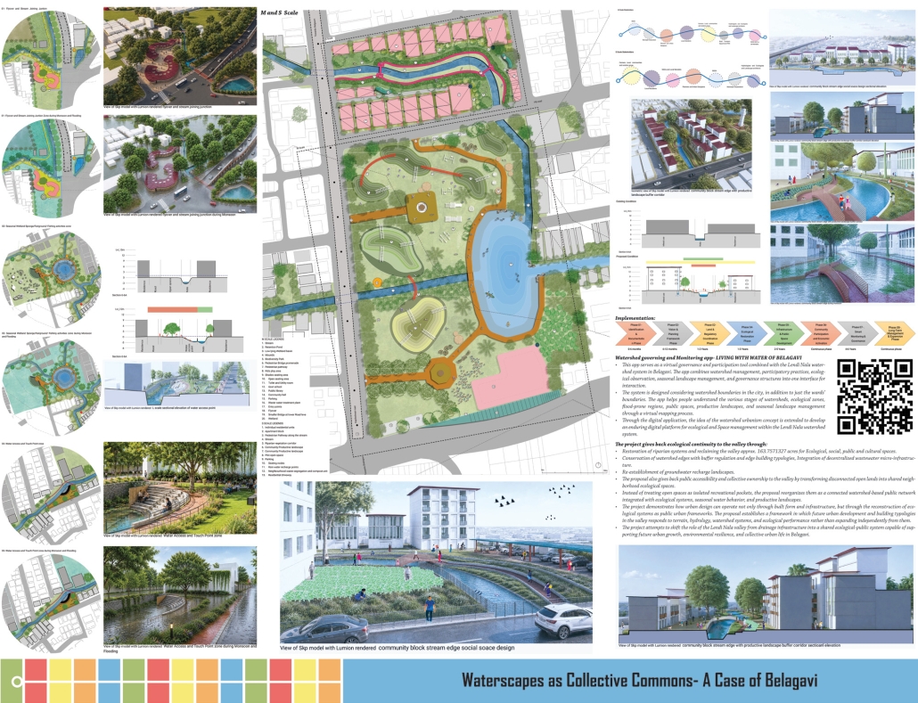
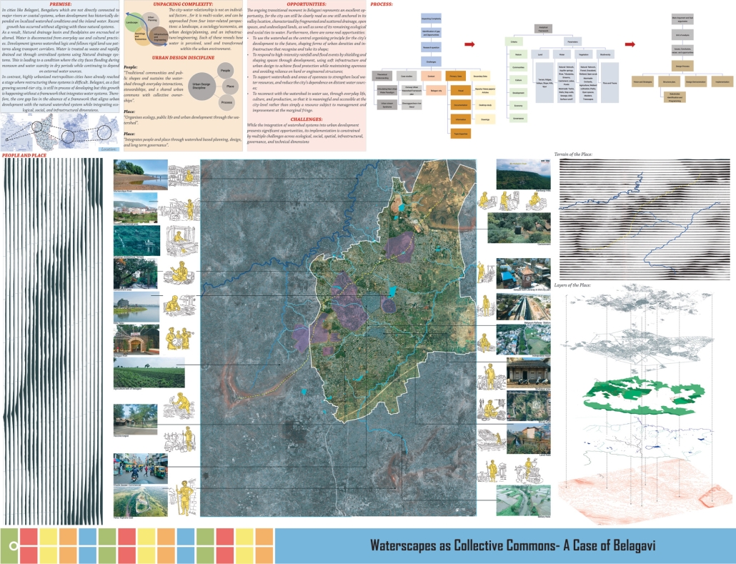
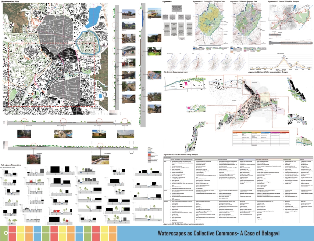
Waterscapes as Collective Commons: A Case of Belagavi City, India by Shruti Dayanand Nargund, M.Arch. in Urban Design ‘26
RV College of Architecture | Advisors: Anup Naik & Seema Maiya U
Under the larger premise of climate change, the Project examines the need to integrate a water-sensitive approach to the design and planning of Indian cities using the case of Belagavi (Karnataka, India), on the cusp of large-scale growth and development with aspirations to become a metropolis. Inspired by the research on Watershed Urbanism, it looks at water- urban frameworks that can be applied in the context of second-tier developing cities in the Global South.
The old historic areas of Belagavi, along the Lendi Nala (canal), are prone to annual cycles of flooding (monsoons) and shortage of water (summer) over the last decade. Instead of the makeshift solutions currently used by people and governing bodies to tackle these water-related issues, the Project establishes the need to first critically understand and then negotiate meaningfully the often conflicting and complex demands (claims) posed by all the stakeholders (species).
Historically, the evolution of Belagavi’s urban (settlement) pattern and its social, cultural, and economic practices can be directly linked to the city’s Watershed (aquifers, streams, catchments, lakes, ponds, wells, and seasonal streams). Over time, the transformation wrought by many factors, like area-based development and physical infrastructure (service and transport corridors) development to promote increased density and growth, indiscriminately occupied the fragile watershed, thus reducing the traditional people-water dependencies and erasing the shared collective memory associated with water.
The Project investigates this changing relationship of City and Water in Belagavi caused by development. It challenges the old water paradigm in design and planning that limits water and, consequently, the natural (ecological) systems within a city, as merely resources to be controlled under infrastructure management. Instead proposes an integrated and adaptive approach or new water paradigm that acknowledges its dynamic (seasonal cycles) character, reinforces the life-sustaining and affirming abilities (tangible and intangible), thus reconnecting people and water (social and public spaces.).
The Study parameters include ecological, social and cultural factors responsible for the current urban condition of the Nala (canal) and Watershed:
- Development patterns (transformation and physical infrastructure) and the disruption of water systems.
- Non-Alignment of Master Planning, Developmental Schemes and projected growth (governance) with natural drainage basin (natural systems).
- Erosion of traditional (sacred and profane activities) community-water relationships.
- Diminishing Ecological performance due to unplanned urban expansion.
The study identifies urban stream syndrome (models of Stationarity, Homogenization, Fragmentation and Centralization); disassociation of local communities with water (walled canal, derelict backyard) and effluent-mixed water inhibiting biodiversity as some of the detrimental factors through mapping (historic evolution) and documentation of the on-ground conditions, including a survey of the stakeholders.
The Project uses scenarios to build a water-secure and livable future for Belagavi by proposing a comprehensive approach, a hybrid that combines engineering and natural solutions for water management; sustainable development and density models along with custodianship (social and public spaces).
Instagram: @shrutinargund, @usmaiya.design
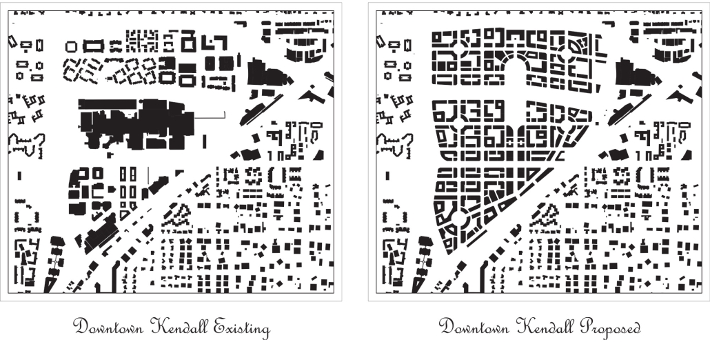

Landscape, Urbanism and the South Florida Watershed: An Urban Design Proposal for Downtown Kendall by Bianca Bernstein & Katerina del Cañal, B.Arch. ’26
University of Miami | Advisors: Joanna Lombard & Tom Klein
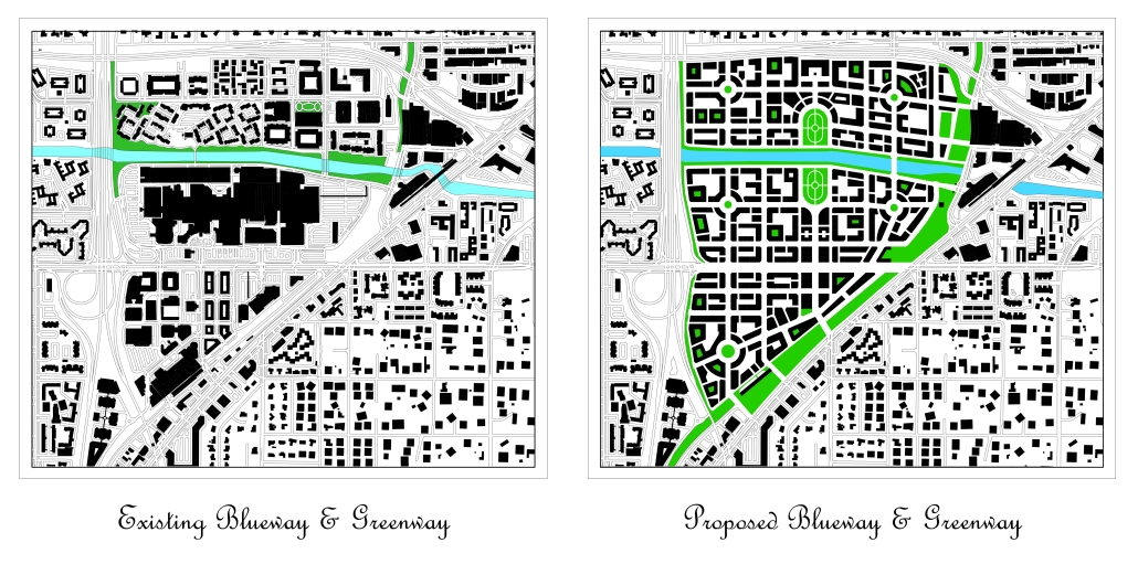
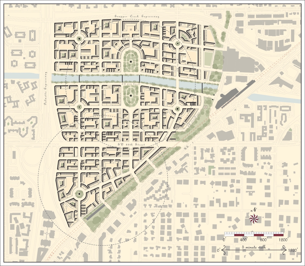
This project for South Miami-Dade builds on current work conducted through the Biscayne Bay and Southeastern Everglades Ecosystem Restoration (BBSEER) Project and the Miami-Dade Back Bay Coastal Storm Risk Management Feasibility Study to develop a design proposal that reintegrates landscape and urbanism within the larger context of South Florida’s stormwater infrastructure and sea-level rise projections. Based on consultations regarding an area of high concern from a climate perspective and opportunity in relation to the density of population served, the project focused on the intersection of the Snapper Creek Waterway with US Highway 1, State Road 826, and the major arterial roadway, Kendall Drive.
Snapper Creek is one of the leading east/west waterways considered to be a critical component of South Florida’s stormwater management system. While currently encircled by heavily trafficked roadways, the site is the southern origin of Miami-Dade’s Metrorail, as well as the new greenways of the Ludlum Trail and the Underline. The bulk of the site is currently occupied by one of the largest shopping malls in South Florida.
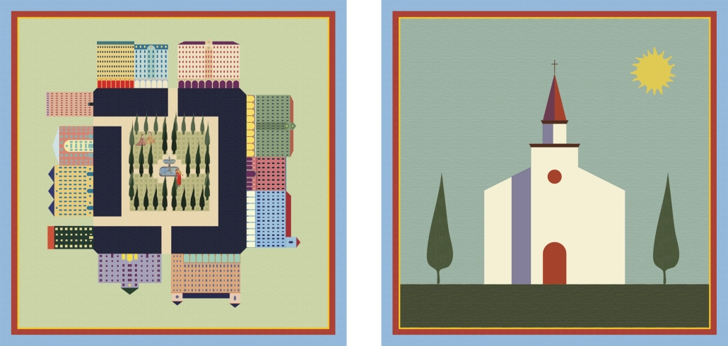
Given the current impact and potential benefits this site could provide, preliminary work explored the history of the site, its current conditions, and projections for its future currently under consideration by local planning authorities. This project proposes to rezone Dadeland Mall as a mixed-use district with public plazas marked by monuments to the site’s geological and human history; and greenways that connect to the Ludlum Trail and Underline to enhance walkability and transit usage. New greenways and promenades along Snapper Creek and Kendall Drive provide shade and increased stormwater retention and percolation.
Project consultants included Victor Dover, founding principal of Dover Kohl & Partners, who led a 1998 Downtown Kendall Plan that was mandated to exempt this site; FIU geo-hydrologist Mike Sukop; UM geologist and marine biologist Sam Purkis and hydrologist Helena Solo Gabriele; Miami-Dade County Parks, Recreation and Open Spaces team members, Irene Cambeyro Gonzalez, Rachael Kardys, and Alex Zizold; and Environmental Risk & Resilience in the Department of Environmental Resources Management leaders, Robert Colón and Nancy Jordan
Instagram: @biancabernstein, @katidelcanal
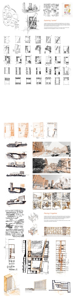
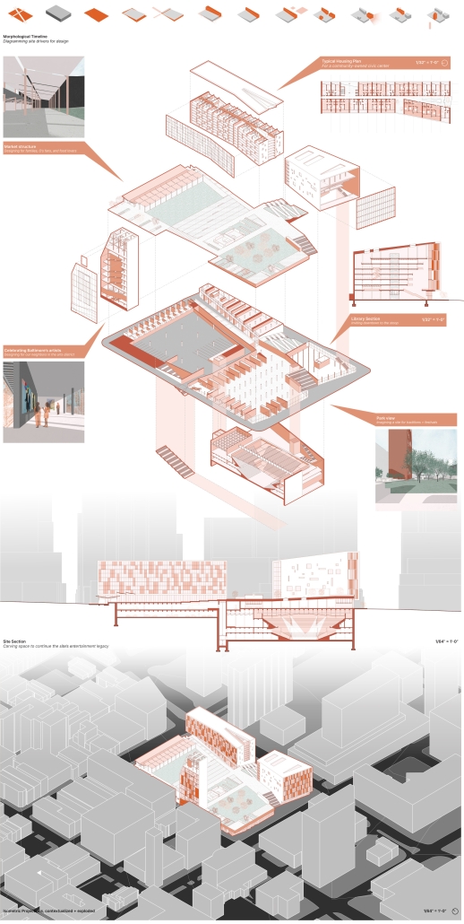
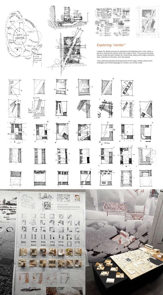
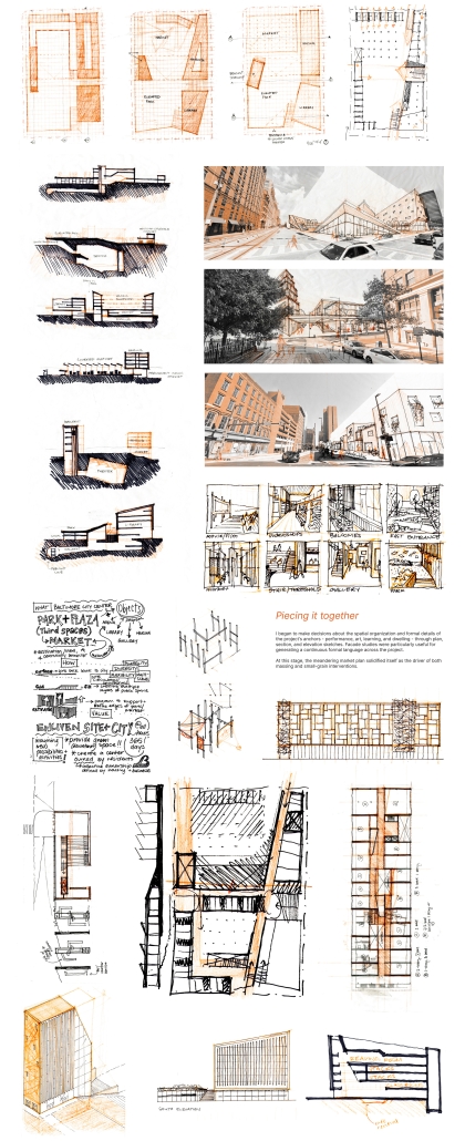
The Stoop: A New Civic Place in Baltimore by Emma Ruth Lohr, BS in Architecture ’26
University of Virginia | Advisor: Mona El Khafif
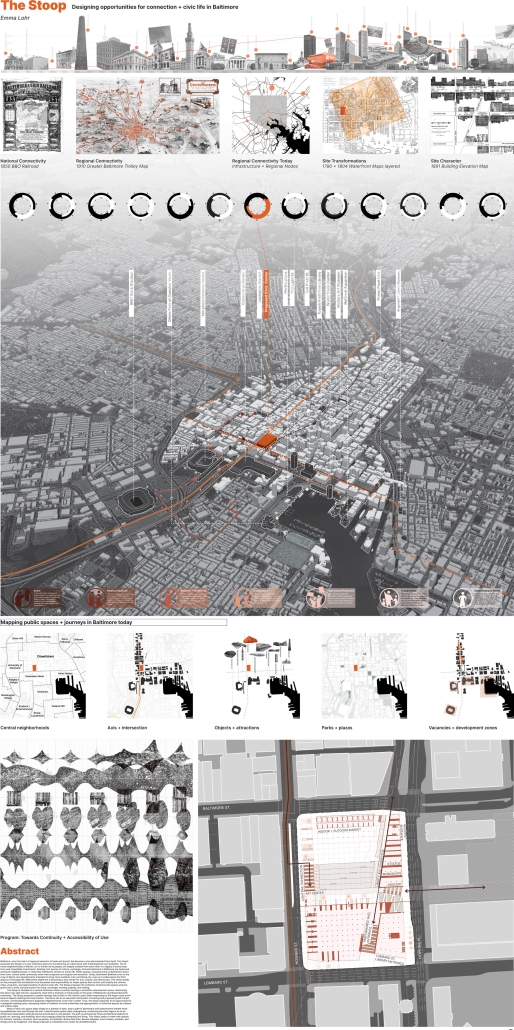
Baltimore, once a hub of regional trade, has become a city disconnected from itself. This thesis proposes transforming an urban block with untapped civic potential into a new collective space. The city’s diverse neighborhoods, known locally as Balmer, are largely isolated due to preconceptions and uneven investments. Civic spaces for culture, exchange, and entertainment are scattered or ineffective. Many downtown spaces fail to foster community because their programs are singular and exclusive. Currently, downtown Baltimore is on the verge of new development aimed at attracting more residents to the shrinking city, but it underestimates the importance of third spaces for daily life. At the same time, Baltimore is emerging as a center for arts, culture, and democracy. This thesis is based on the idea that architecture can create spaces that support vibrant communities, programs, and opportunities. The project, called The Stoop, seeks to gather democratic spaces and programs into a lively, diverse place for living, exchanging, working, playing, and creating.
The Stoop is situated on a central downtown block currently housing a monolithic entertainment arena. Historically, this block was split into four quadrants, lined with a diversity of small shops in the grain of Baltimore’s quintessential brick rowhomes. The Stoop proposes a spatial strategy that builds on this historic grain while responding to the larger-scale architectural objects defining the Inner Harbor. The block sits at an essential intersection of existing and proposed public transit rail lines, connecting Baltimore’s disparate neighborhoods at the city’s center. Thus, the Stoop responds to the opportunity to create a designed meeting place, disrupting habits of isolation and inviting ownership and appropriation of collective spaces by citizens and visitors alike.
Much of this civic space takes shape as a blanket of park, atop a path of permanent and impermanent market, drawing pedestrians into and through the site. A performance space slips underground, continuing the site’s legacy as an entertainment destination while giving the ground back to the people. The park is anchored by three architectural objects for public art, learning, and dwelling, each encouraging collective ownership and living. This thesis seeks to make new spaces for farmers’ markets, concerts, pick-up games, art festivals, library field trips, Ravens tailgates, lunch breaks, protests, and things yet to be imagined. The Stoop proposes a revitalized civic center for all Baltimoreans.
Instagram: @aschool_uva, @monaelkhafif
Regenerative Change: the Triple-Decker by Kira Verrier Moran, BS in Architecture ’26
University of Virginia | Advisor: Mona El Khafif
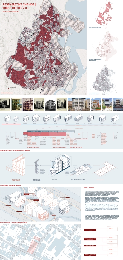
A triple-decker is a New England housing type defined by its three-story height and stacked decks. These homes are essential to Boston’s extended urban fabric, first appearing in the streetcar suburbs that developed on the city’s edges in the mid to late 1800s. Small-scale multifamily housing types, like the triple-decker, are becoming increasingly important as the availability of housing options and affordability become almost impossible in cities like Boston.
Dorchester is the largest neighborhood in Boston and has the greatest number of triple-decker structures. The neighborhood has a long-standing history of diversity, vibrancy, and a strong sense of community. At this moment, the residents are experiencing a high-cost burden, a severe lack of affordable housing options, and gentrification. Many longtime residents are being pushed out due to increased rents, and foreclosures have left many residential parcels empty for years.
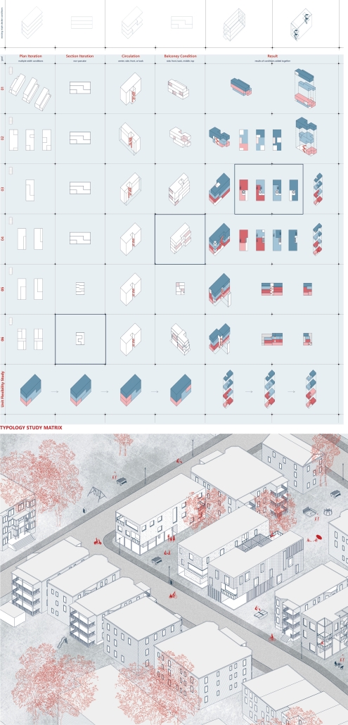
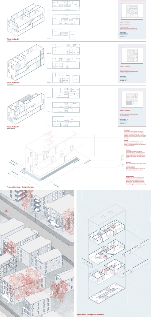
This project focuses on recognizing the advantages and identifying the drawbacks of the triple-decker housing type and cultivating the best aspects to develop a new version of the typology that addresses the needs of Bostonians in the 21st century. The project goal is to provide housing design solutions that densify in a careful, resident-centered, and contextual manner while striving for community connection and engagement by adapting the traditional structural model of living to the diverse lifestyles of Dorchester residents.
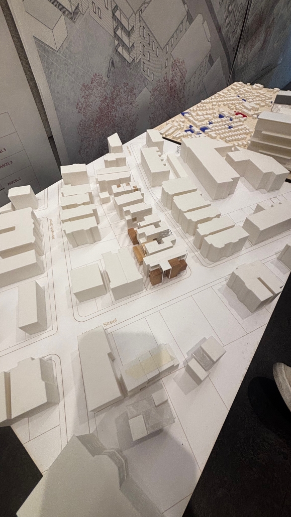
The proposal is a set of three small-scale multifamily housing designs that can be distributed by the city on vacant land parcels, providing a more dynamic and better-suited living space for residents while unifying and connecting the urban fabric of Dorchester.
Instagram: @aschool_uva, @monaelkhafif
Urbanism as Continuum by Walter Workman, B.Arch.’26
Tulane University | Advisors: Ammar Eloueini & Juan Medina
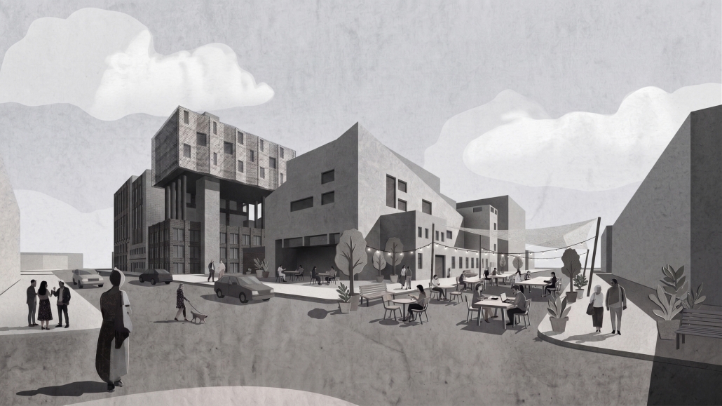
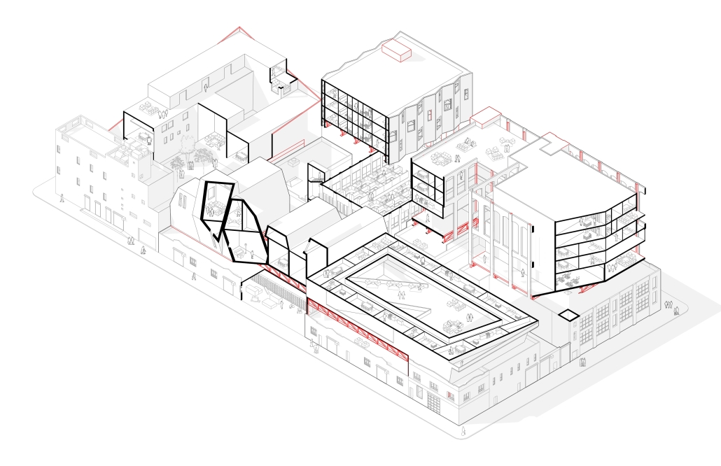
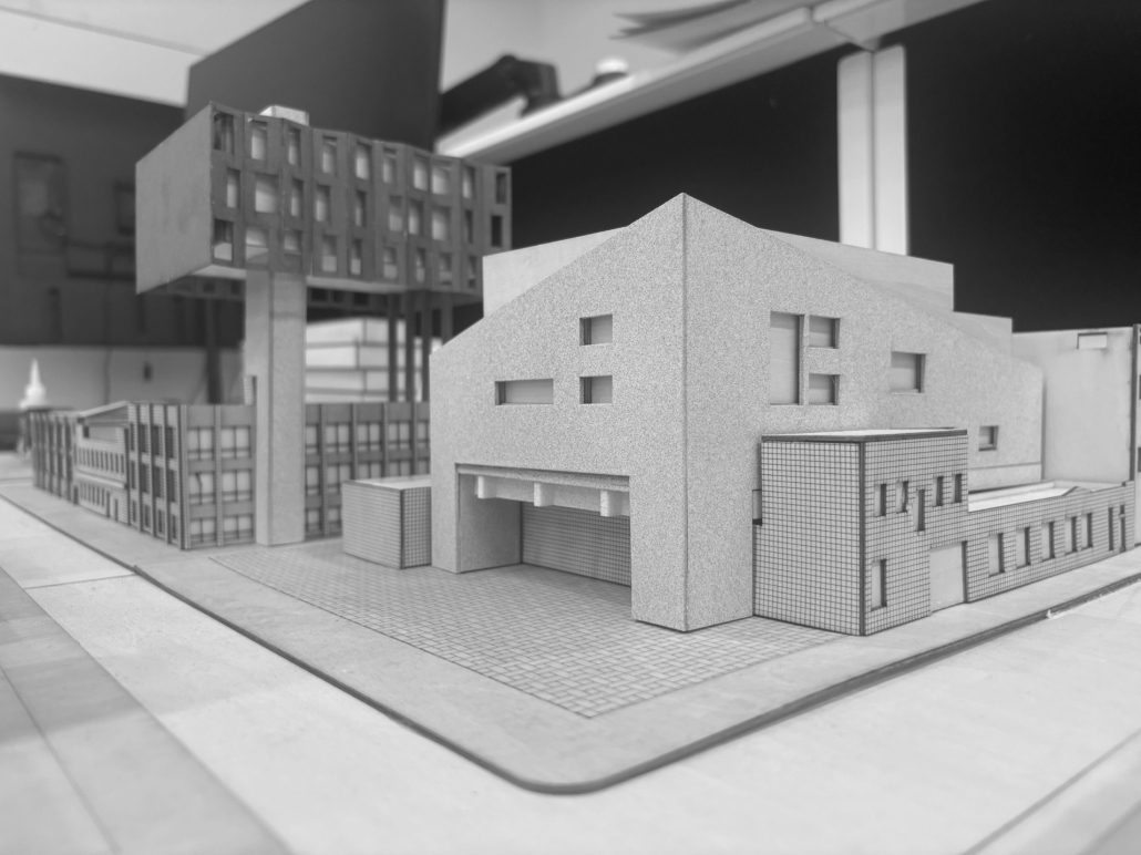
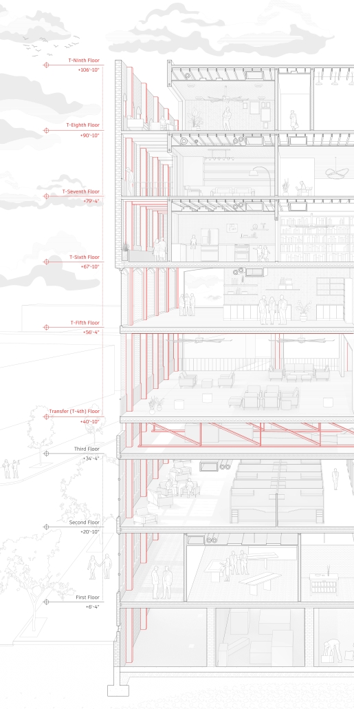
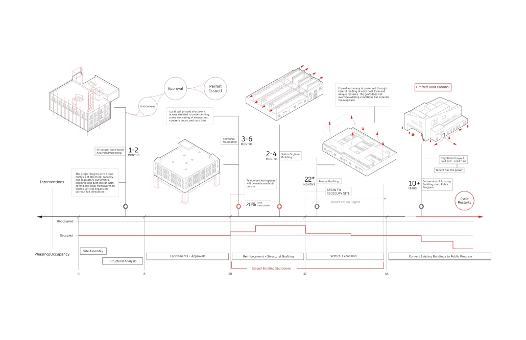
Urbanism as Continuum proposes urban grafting on the block scale as an alternative to demolition-based development in New York City’s industrial districts, treating architecture as an open-ended framework rather than a finished object. By threading an autonomous structural system through active warehouse districts, new housing accumulates incrementally above working industrial floors, generating mixed-use density without displacing the economies below. Existing building stock is preserved and woven into new construction, allowing the neighborhood to grow from within, thickening its fabric rather than replacing it and sustaining the social continuity that erasure-driven development forfeits. Current tenants are given control over their future in the neighborhood with a stronger voice towards move-out dates and have increased leverage for negotiations with future developers.
Click here to take a closer look.
This project received Thesis Commendation during the Tulane School of Architecture and Built Environment Diploma Ceremony, May 2026.
Instagram: @wbwarchitecture, @eloueini, @salazarsequeromedina
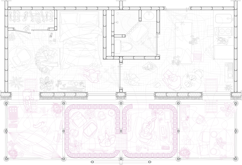
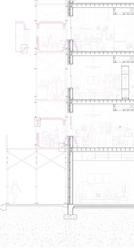
Pneumatic Expansion: AIRchtecture in New York’s Scaffolding by Caleb Schroeder, B.Arch. ’26
Tulane University | Advisors: Ammar Eloueini & Juan Medina
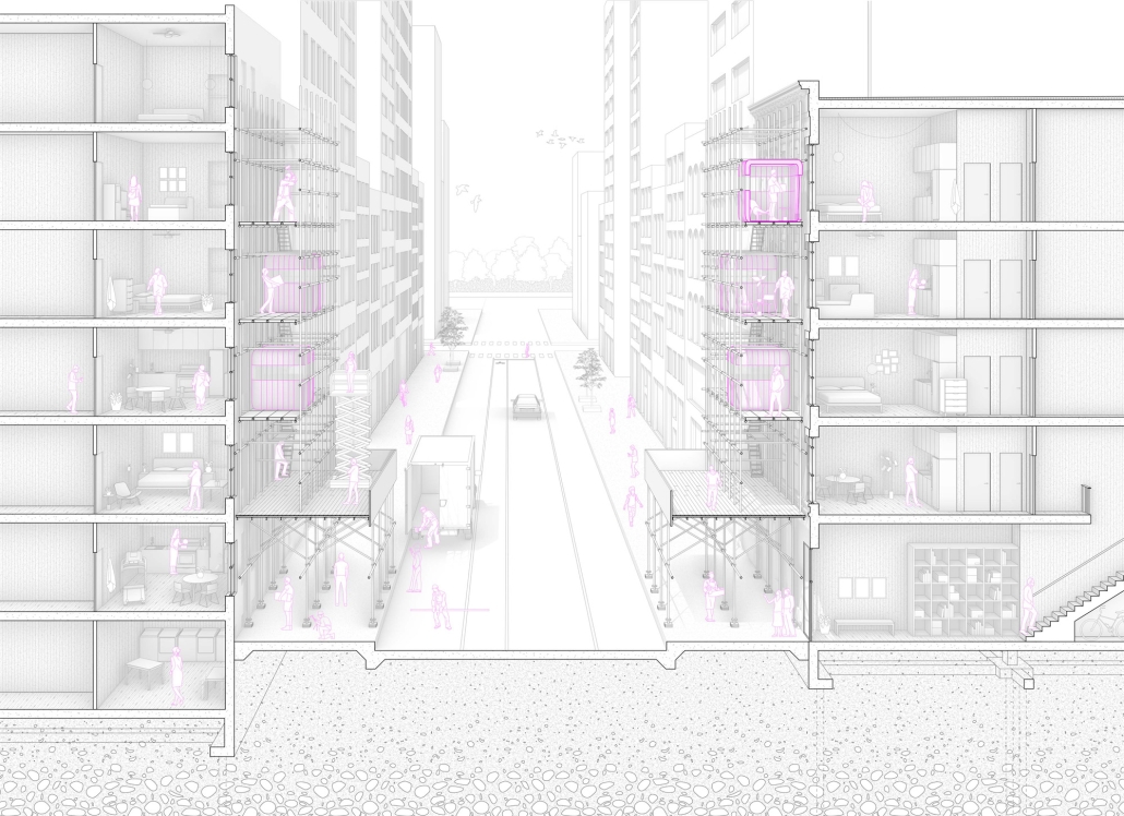
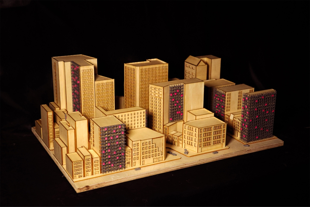
New York City’s scaffolding has become a ubiquitous, overlooked feature of the urban landscape, occupying sidewalks and facades for years or decades beyond its lifespan. Originally conceived as a temporary maintenance device, scaffolding now operates as a persistent infrastructural framework that mediates between buildings and streets.
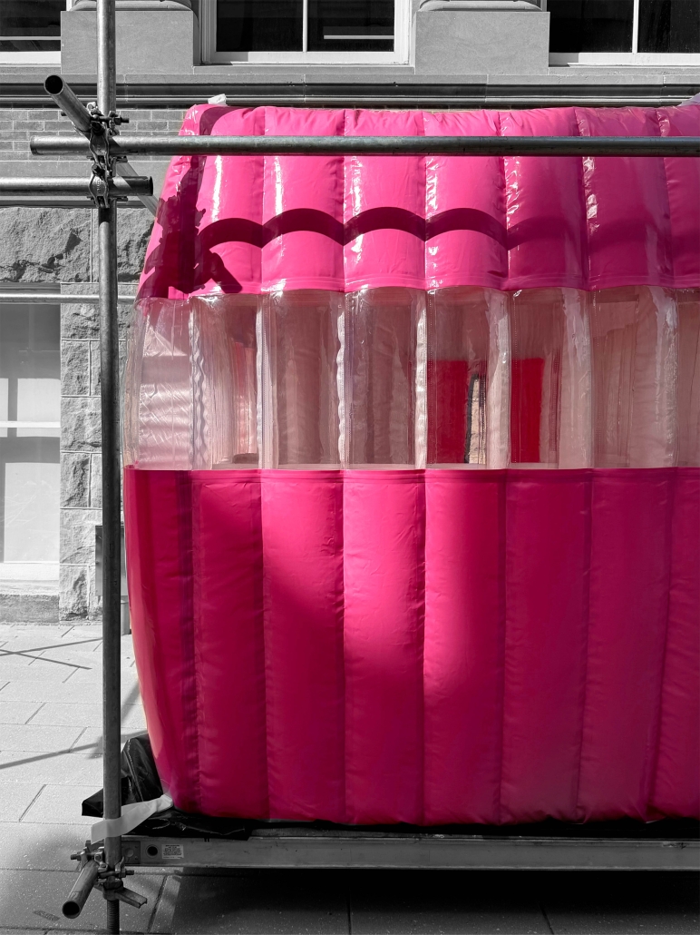
This thesis reframes New York City’s vast stock of scaffolding as a prolonged condition supporting occupation through the insertion of inflatable volumes. Operating in a temporary condition, these modules position impermanence as a generative spatial strategy, enabling architecture to transform in response to surrounding urban conditions. The outcome explores how inflatable interventions can expand beyond architectural typologies, recasting scaffolding not as a provisional maintenance device, but as an active framework for evolving urban occupation.
Click here to take a closer look.
This project received Thesis Commendation during the Tulane School of Architecture and Built Environment Diploma Ceremony, May 2026.
Instagram: @cschroederarch, @eloueini, @salazarsequeromedina
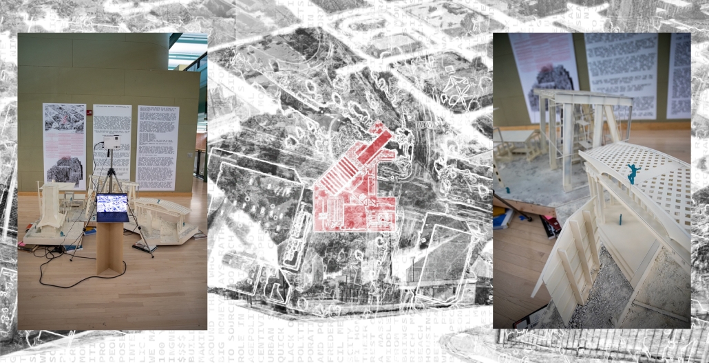
city-building machine; jacksonville, fl by Zach Vontz, B.Arch. ’26
Penn State University | Advisors: Peter Aeschbacher & Rebecca Henn
Architecture exists problematically; both in its own existence and in response to existence. Across history and into the present, the discipline has changed. Technological advancement has created an interdisciplinary globalization. Simultaneously, political-economic structures, primarily in the neo-feudal, capitalistic American societies, have pushed to further isolate the Architect from the architecture and the designers from the citizens.
There is the built world. The economist. And then the architect. Design is at the will of the economist. Architects have lost agency. Civilians have lost agency. And the city (a semi-mythic organism comprised of diverse, individual, and isolated architectural tissues) should be responsible for facilitating and cultivating an environment suitable for the civilian, but is not held responsible for anything but cultivating an environment suitable for the economist
We (the architect, the civilian, the economist, and the city) must rebuild the machine.
The City-Building Machine is an attempt at an architectural solution to these systematic problems within and about the discipline of architecture. The machine is a network of buildings, pre-existing and imagined, situated central to its urban environment. The machine is not the singular solution to a city’s ailments but rather its in-home physician. It is constructed to ignore immediate temporal situations for the sake of catalyzing change. It embodies the character and the culture of the city aesthetically.
The machine builds. The machine destroys. The machine recycles. The machine educates. The machine platforms. The machine houses. The machine connects the civilian to their city and connects its context to its inhabitants. The machine embodies the synthesis of its products.
This piece acts as an outpost of sorts in which architect(s) inhabit and practice. It seeks to present aesthetic solutions to an economic city and engage publicly in discourse with civilians. The architect works in the open to collect, record, and archive the architecture of Jacksonville, Florida. The architect is now given a level of individual and professional agency and is an inhabitant of place. The architecture is of place and accessible to both the architect and the civilian passing by, and the civilian is no longer physically removed from the design process.
Setting Distance on Manhattan Island by Mengmeng He, MS in Advanced Architectural Design program (M.S. AAD) ’26
Cornell University | Advisors: Jennifer Newsom, Andrea Simitch & Esra Akcan
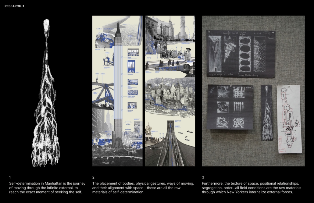
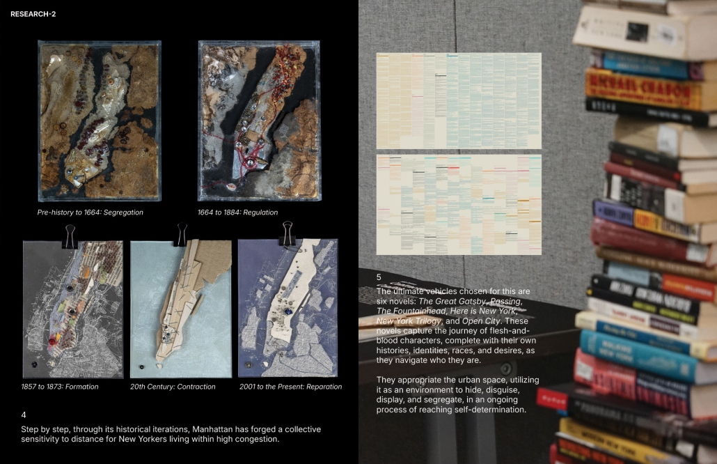
In Manhattan, ‘setting distance’ does not mean moving away from others: it means artificially producing difference, buffering, and deviation within the ongoing proximities. Individuals negotiate a controllable position by adjusting their distance from others, from institutions, from places, from narratives and imaginaries. This distance is not always abstract. It can be anchored in specific urban fragments: a building, an address, a route, an occupation, a misread identity, or even an imagination of the city itself.
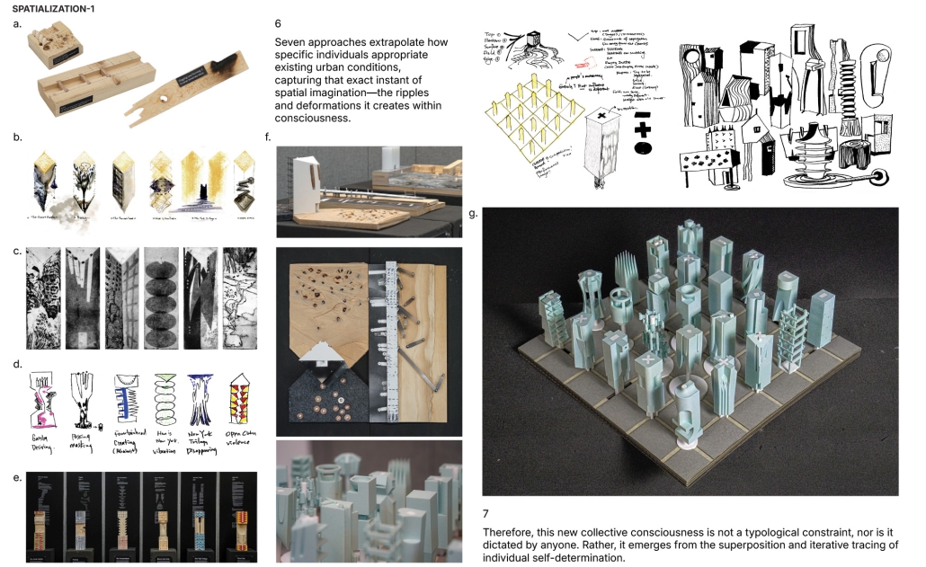
This also explains why, across a century of literary production, Manhattan has never appeared as a unified subject, nor consolidated into a shared identity. Instead, it appears as a constellation of subjects, each of whom chooses to enter negotiation and continually renegotiate their consequences. Gatsby [The Great Gatsby] performs desire to claim position; Clare [The Passing] operates identity between legibility and misrecognition; Roark [The Fountainhead] establishes autonomy through architectural form; White [Here Is New York] uses anonymity within crowds to secure privacy; Quinn [The New York Trilogy] allows the grid to overwrite the self; Julius [Open City] moves between memory and history, maintaining identity through movement. In each text, Manhattan is not a backdrop, but an active medium through which the self is tested, translated, and equipped through distance. And distance is not a static condition, but an active verb—set, stretched, compressed, shifted, and at times suspended.
This project translates these verbs into space.
First, Manhattan is presented as a singular body, unified in its historical foundations, urban design and planning, infrastructural impositions, and systemic healing.
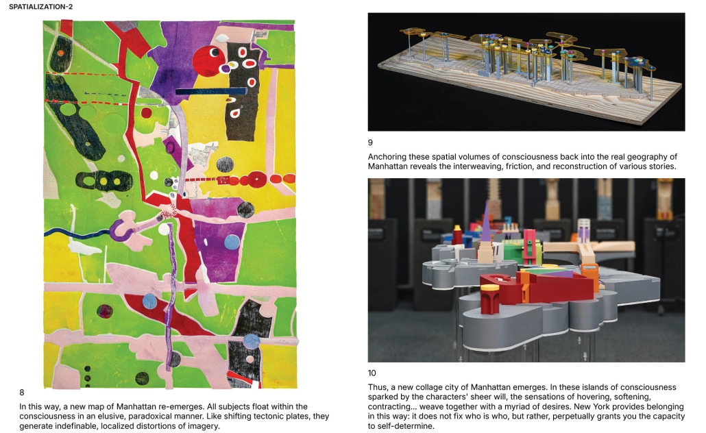
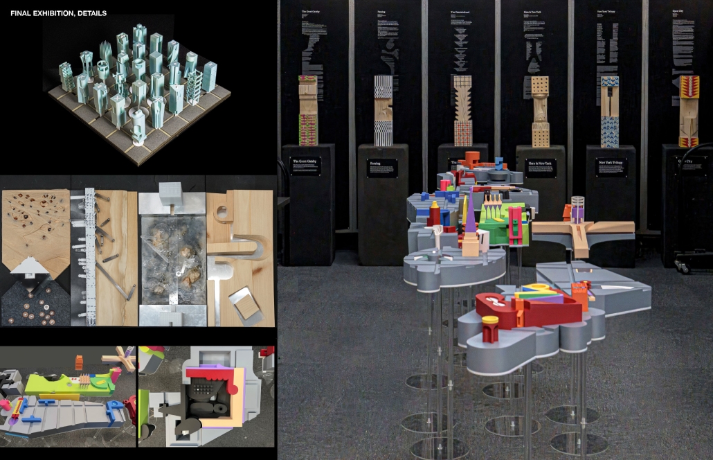
Then, by mapping these narrative moments onto the island, Manhattan is reorganized into a second geography, shaped not only by infrastructure, but by acts of setting distance. This geography appears as a chain of self-determined fragments suspended between contact and withdrawal. Each fragment records a moment in which autonomy is contested, recalibrated, or provisionally secured; not materialized as a stable possession but continuously generated through friction—between bodies and spatial structures, and between individuals and an island that both enables agency while resisting a totalizing realization.
This project received the Post-Professional M.S.AAD Award for outstanding academic achievement in a year-long thesis in the four-semester program on May 24, 2026.
Instagram: @meng2he
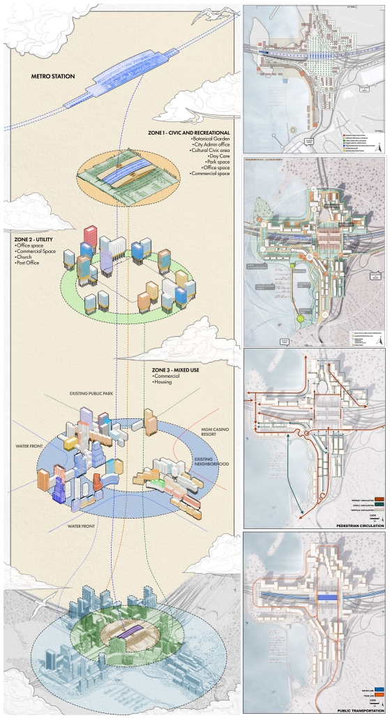
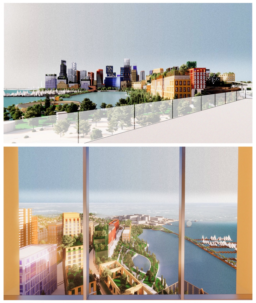
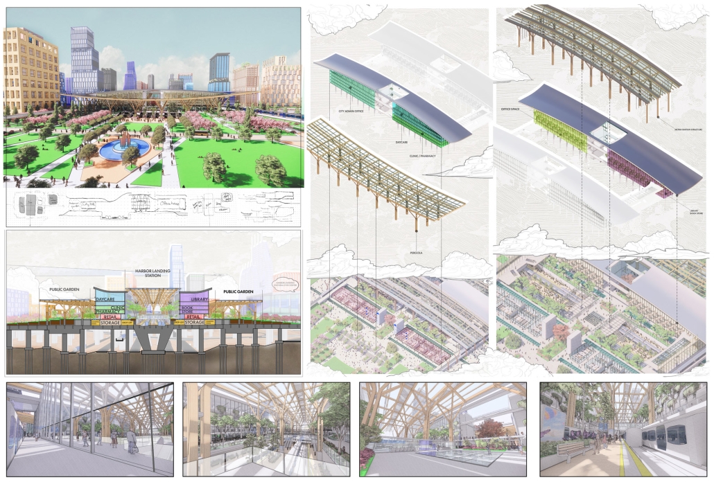
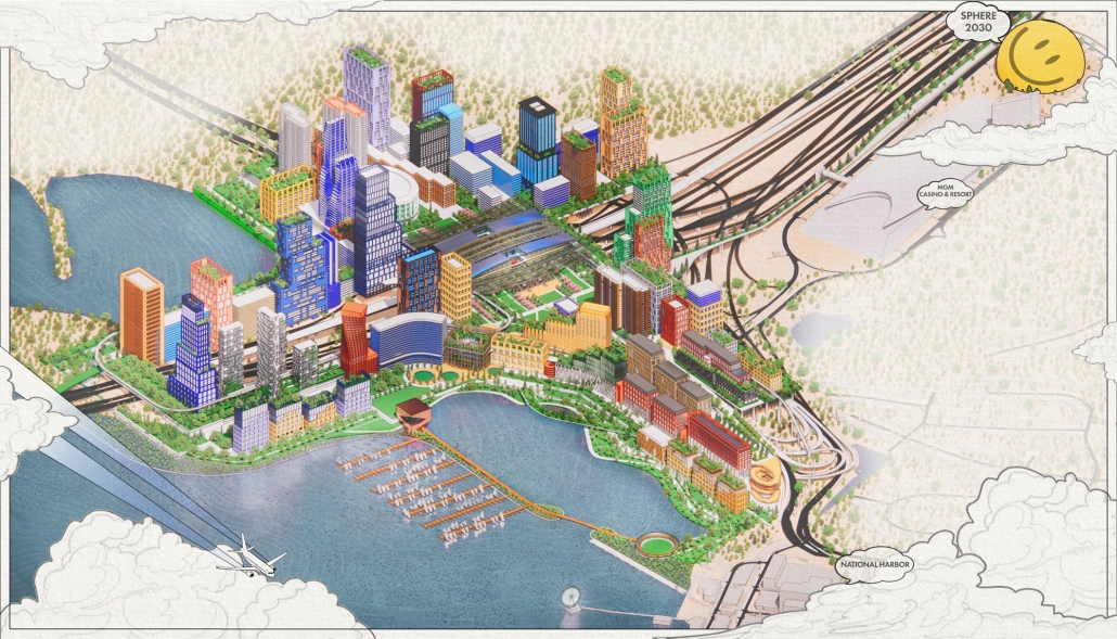
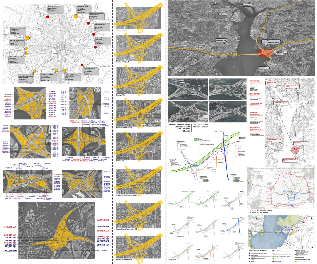
Inhabiting the Interchange by Thanh Thuan Hoa “Will” Nguyen, M.Arch. ’26
Virginia Tech & Washington-Alexandria Architecture Center | Advisors: Elizabeth Keslacy, Ezgi Isbilen & Scott Archer
Inhabiting the Interchange is a thesis that explores the potential to retrofit neglected spaces in urban infrastructure, particularly the underutilized areas of freeway interchanges, into thriving new urban developments. This approach serves as a strategy to combat urban sprawl.
The vision presented in “Inhabiting the Interchange” aims to transform these wasted spaces into a high-density living environment for 30,000 residents, all without encroaching on valuable farmland or undisturbed land. Traditional low-density housing developments often result in land loss while housing fewer individuals, necessitating even more undeveloped land to accommodate the same population. This not only results in habitat loss but also requires the construction of new infrastructure, which contributes to environmental challenges by increasing carbon emissions and intensifying urban heat islands. The distance of these low-density developments from city centers leads to rising vehicular traffic, worsening congestion, and negatively affecting both mental and physical health. Ultimately, urban sprawl causes ecological damage, resource depletion, and habitat loss.
Urban retrofitting stands out as a promising strategy to mitigate these issues, yet the current opportunities for such initiatives are limited. Fortunately, there is significant potential in the Washington, D.C. area and other major cities across the U.S., where hundreds of acres of land remain underutilized within interchange spaces. This thesis envisions reimagining and reclaiming these overlooked areas, transforming them into a high-density, sustainable community that contributes positively to the urban landscape.
This project received the 2026 Virginia Tech Thesis Prize Honorable Mention.
Instagram: @willyn.02, @vt_waac, @keslacye, @e_isbilen
Stay tuned for Part II!